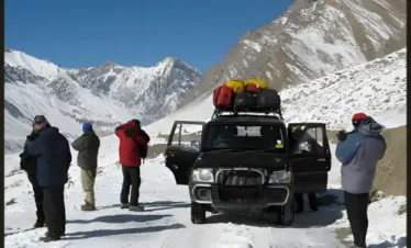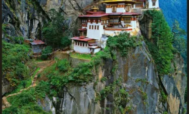
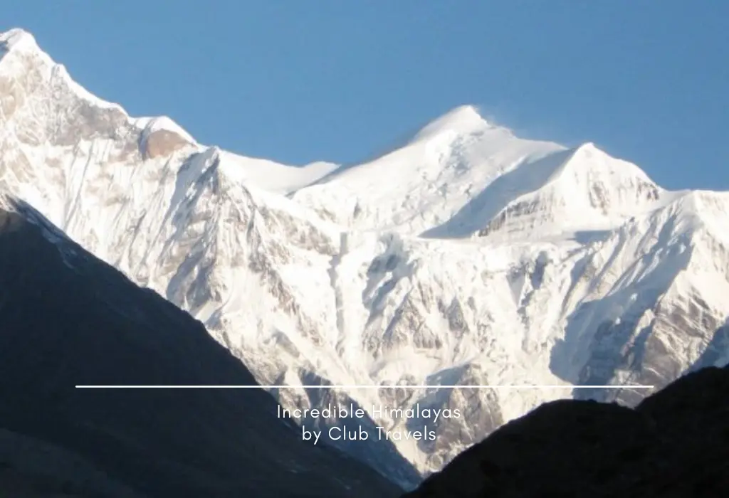
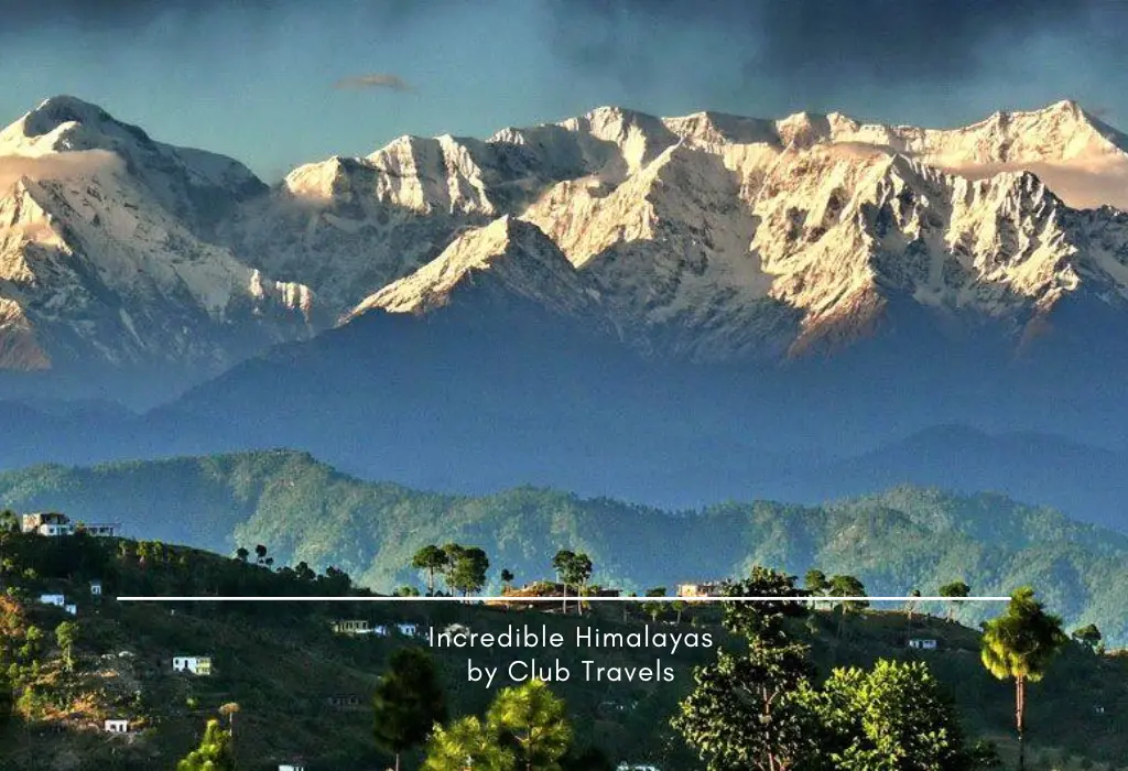
WELCOME TO INCREDIBLE HIMALAYAS
Explore Himalayas Mountains
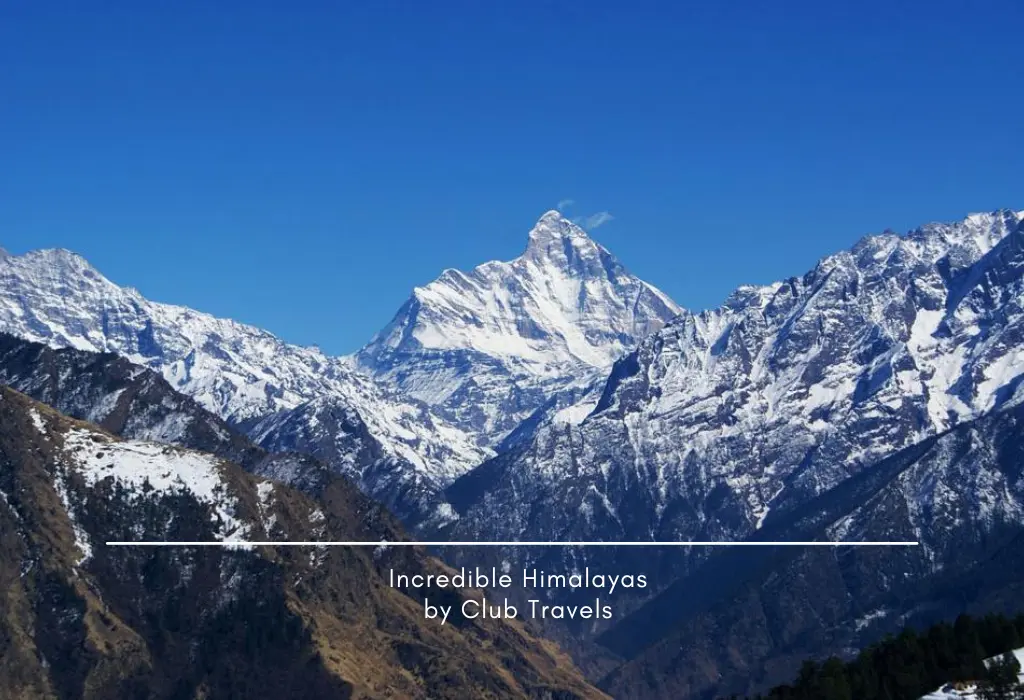
Himalayan Mountains – Where Earth Touches the Sky
Average Width : 200-km
Himalayan Coverage area : 2,250-km
Himalayan Forest : Pine, Deodar, Fir, Oak, Rhododendron, Birch
Monsoon Season : Mid-June Till The End of September
The Himalaya can be divided into four zones parallel to each other:
- The Siwalik foothills – 5 to 50 km. wide and their altitude rarely exceeds 1500m. This region is generally covered with damp forest.
- The Lesser Himalayan Zone – 40 to 80 Km wide and of an average altitude of about 3050M. In the lower slopes are found magnificient forests of chir, deodar, the blue pine, oak and mangolias, whereas above 2450 m. are found brich, spruce, silver fir and other species.
- The Great Himalaya – Comprising the Zone of high snow-caped peaks which are about 150 or 160 Km. from the edge of the plains, this consists of lower alpine zone up to 4875 M. and upper snow-bound zone usually above 4575M. to 5100 M. The alpine zone has rhododendrons, thick shrubs with variety of beautiful flowers and grass.
- The Trans Himalayan Zone – About 40Km. in width, encompassing the valleys of the rivers rising behind the great Himalaya, these river basins are at an altitude of 3600M. to 4250M
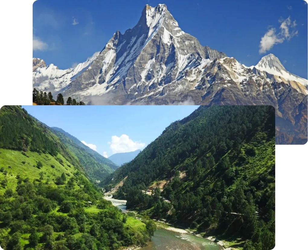
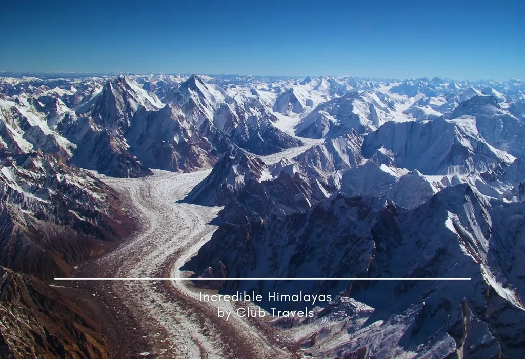
Mountains of Himalayas
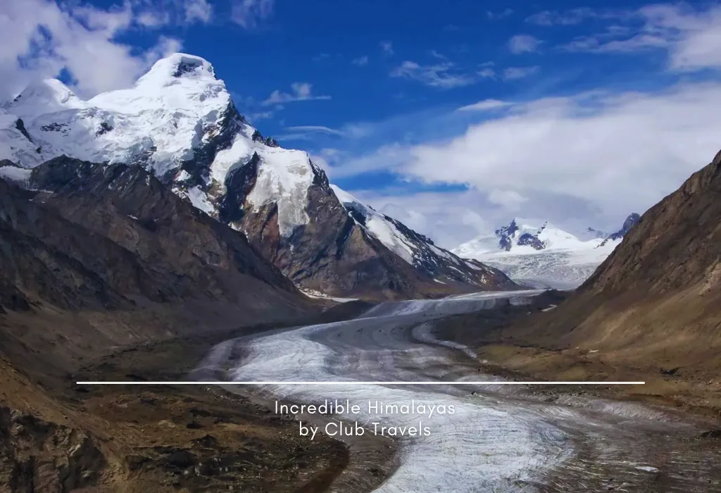
Zanskar Himalayan Range
The Zanskar Range is a major mountain system in Ladakh, lying predominantly south of the Indus River and forming a dramatic barrier between the Indus Valley and the remote Zanskar region. It stretches from the stark ridges beyond Lamayuru in the west and runs eastward across Zanskar, shaping one of the most rugged and least accessible landscapes of the western Himalaya.This range is distinctly separated from the Greater Himalayan Range by the Stod (Doda) and Tsarap valleys, which together create the Zanskar Valley. These valleys support most of the region’s settlements, agriculture, and historic monasteries, making them the cultural and economic heart of Zanskar.A defining feature of the range is the Zanskar River, which cuts through the mountains as it flows northward. Over thousands of years, the river has carved deep, spectacular gorges, creating one of the most striking river corridors in the Himalaya. The river finally meets the Indus River near Nimmu, close to Leh, marking a dramatic confluence amid towering cliffs and barren mountains.
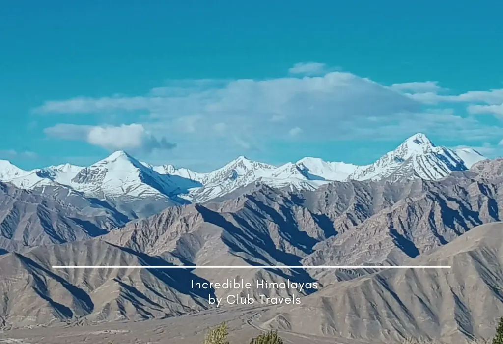
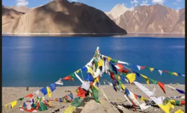
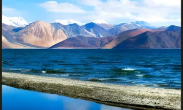
Ladakh Himalayan Range
Ladakh, the Land of High Passes, is a truly unique Himalayan region, shaped by dramatic geography and some of the most powerful mountain landscapes on Earth. To the south, it is bordered by the Great Himalayan Range, while the northern edge is dominated by the rugged, glacier-rich Karakoram Range, home to some of the world’s highest peaks.Cutting across Ladakh are two significant mountain ranges—the Ladakh Range and the Zanskar Range. The Ladakh Range runs parallel to the Indus River, separating the fertile Indus Valley from the cold desert landscapes of Nubra and Shyok, while the Zanskar Range rises south of the Indus, forming a natural barrier between Ladakh and the isolated Zanskar Valley.These ranges influence Ladakh’s high-altitude desert climate, sparse vegetation, and striking visual contrasts, while shaping its culture, ancient trade routes, and settlement patterns. Today, the Ladakh Himalayan Range attracts travelers, trekkers, and adventure seekers drawn by raw natural beauty and an authentic Himalayan experience.
East Karakoram Range
The East Karakoram Range is a vast and powerful mountain system that forms an important geographical divide between India and Central Asia. Located in the northernmost part of Ladakh, this remote and rugged range is known for its extreme terrain, massive glaciers, and some of the least explored landscapes in the Himalaya–Karakoram region.The range includes several prominent high peaks such as Teram Kangri, Saltoro Kangri, and the Rimo group of peaks, all of which rise sharply above the surrounding ice fields and barren plateaus. These mountains are surrounded by extensive glaciers, including parts of the Siachen and Rimo glacier systems, making the region one of the coldest and most inhospitable on Earth.Historically, the Karakoram Pass played a crucial role as a high-altitude trade route. It served as a key link between Leh in Ladakh and the Central Asian trading centers of Yarkand and Kashgar, facilitating the exchange of silk, spices, and other goods along ancient caravan routes. Today, the East Karakoram Range stands as a symbol of raw natural power, strategic importance, and historical connectivity between South Asia and Central Asia.
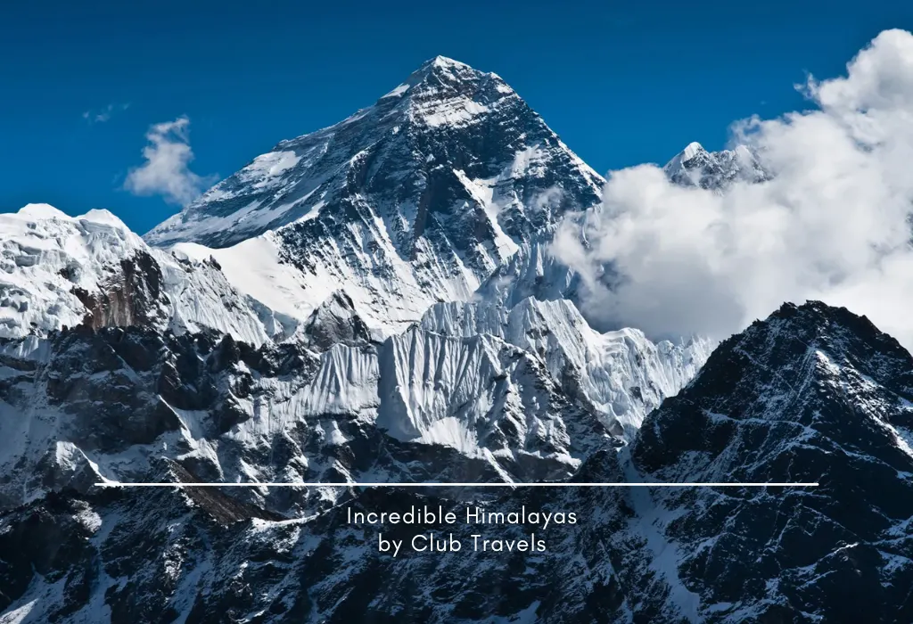
Mount Everest, Nepal highest peak of the world
Mount Everest is the highest mountain peak in the world, rising to an elevation of 8,848.86 meters above sea level. Located in the Himalayan range of Nepal, along the border between Nepal and the Tibet Autonomous Region of China, Everest stands as a powerful symbol of human ambition and natural grandeur. In Nepal, the mountain is known as Sagarmatha, meaning “Goddess of the Sky,” while in Tibet it is called Chomolungma, meaning “Mother Goddess of the World.”The peak was officially named Mount Everest in honor of Sir George Everest, the former Surveyor General of India, following a 19th-century survey that identified it as the world’s highest point. Interestingly, Sir George Everest himself never saw the mountain that bears his name.Mount Everest gained global recognition in May 1953, when Tenzing Norgay Sherpa of Nepal and Sir Edmund Hillary of New Zealand became the first confirmed climbers to reach its summit. Their historic ascent marked a major milestone in mountaineering history.Today, Mount Everest continues to inspire climbers, adventurers, and travelers from around the world, representing courage, endurance, and the timeless allure of the Himalayas.
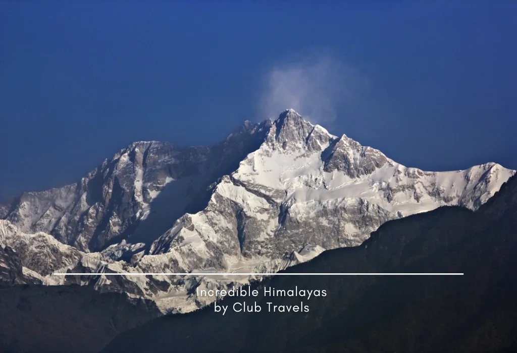
Kangchenjunga 1st Higest Peak in India
Kangchenjunga is the highest mountain peak in India and the third highest in the world, standing at 8,586 meters (28,169 feet) above sea level. Located in the Great Himalayan Range along the India–Nepal border, it dominates the eastern Himalayas with its massive, snow-covered presence.The name Kangchenjunga means “The Five Treasures of Snow” in Tibetan, symbolizing gold, silver, precious gems, grain, and sacred books. True to its name, it consists of five major peaks, four of which rise above 8,450 meters, making it one of the most formidable mountain systems in the world. Revered as a sacred mountain, climbers historically stopped just short of the true summit out of respect.Surrounded by the Kangchenjunga National Park, a UNESCO World Heritage Site, the region is rich in biodiversity and pristine alpine ecosystems. It continues to inspire awe with its raw beauty, spiritual significance, and breathtaking Himalayan scenery for travelers, trekkers, and mountaineers alike.
Kamet 2nd highest mountain peak in Garhwal Himalayas
Kamet is one of the most prominent mountain peaks in the Garhwal Himalayas and holds the distinction of being the second highest peak in this region. With an impressive elevation of 7,756 meters, Kamet is also the third highest mountain peak in India. It is located in the Chamoli district of Uttarakhand and forms the highest summit of the Zanskar mountain range within the Garhwal region.The mountain lies close to the Indo-Tibetan border, positioned north of the main Himalayan axis, which makes it more remote and less accessible compared to many other well-known Himalayan peaks. Kamet is surrounded by three major neighboring peaks—Abi Gamin, Mukut Parbat, and Mana Peak—adding to its dramatic alpine setting.Despite its isolation, Kamet is considered relatively approachable for experienced climbers. The standard climbing route begins from the East Kamet Glacier, crossing Meade’s Col before ascending along the northeast ridge of the mountain’s north face. First successfully climbed in 1931, Kamet remains a respected challenge in Indian mountaineering, admired for its height, remoteness, and striking Himalayan scenery.
Nanda Devi, Uttarakhand 2nd highest mountain in India.
Nanda Devi is the second highest mountain peak in India, rising to an impressive height of 7,824 meters (25,663 feet) above sea level. It holds a unique distinction as the highest peak located entirely within India, since Kangchenjunga lies on the India–Nepal border. Situated in the Garhwal Himalayas of Uttarakhand, Nanda Devi is revered for both its natural grandeur and deep spiritual significance.Before the discovery of Dhaulagiri in 1808, Nanda Devi was believed by western surveyors to be the highest mountain in the world. The peak forms part of the Nanda Devi massif, which consists of two main summits—Nanda Devi (West), the higher and main peak, and Nanda Devi East, located slightly to the east. Together, they dominate one of the most spectacular mountain landscapes in the Himalayas.Surrounded by the Nanda Devi National Park, a UNESCO World Heritage Site, the region is known for its pristine beauty, rare wildlife, and fragile alpine ecosystems. Due to its ecological sensitivity and religious importance, access to the inner sanctuary is highly restricted, preserving Nanda Devi as one of India’s most protected and awe-inspiring Himalayan peaks.
Saltoro Kangri peak better known as the Saltoro Range, Karakoram.
Saltoro Kangri is the highest peak of the Saltoro Range, a prominent sub-range of the Karakoram mountain system, located in the northern region of Ladakh (Kashmir). The Saltoro Range lies at the heart of the greater Karakoram and runs close to the eastern edge of the famous Siachen Glacier, one of the longest glaciers outside the polar regions. This remote and high-altitude region is known for its extreme climate, vast ice fields, and rugged terrain.Rising to an elevation of 7,742 meters (25,400 feet), Saltoro Kangri is ranked as the 31st highest independent mountain peak in the world. The mountain stands isolated from major climbing routes, making it one of the least accessible high peaks in the Karakoram. Its surrounding landscape is dominated by glaciers, steep ridgelines, and sharp ice-covered faces.Due to its strategic location and harsh environment, Saltoro Kangri has seen limited mountaineering activity and remains largely unexplored. The peak represents the raw, untamed character of the Karakoram and highlights the immense geological power of the Himalayan mountain systems, attracting interest from seasoned mountaineers and high-altitude explorers.
K12 2nd highest peak in the Saltoro Mountains
K12 is the second highest peak in the Saltoro Mountains, a rugged subrange of the Karakoram Range, located in the Siachen region near Jammu and Kashmir. Rising in a remote and strategically sensitive area close to the Line of Control (LoC), K12 remains one of the least known yet geographically important peaks of the Karakoram.The mountain’s name, K12, originates from its numerical designation during the original Karakoram Survey, when many peaks were identified and named based on their order rather than traditional local names. K12 is positioned southwest of the Siachen Glacier, and the K12 Glacier, which forms on its northeastern slopes, feeds directly into the Siachen Glacier system.On the western side, the slopes of K12 drain into the Bilafond Glacier, which eventually contributes to the Dansam River and later merges with the mighty Indus River. Surrounded by massive glaciers and steep ridgelines, K12 is characterized by extreme weather conditions and difficult access.Due to its harsh terrain and geopolitical sensitivity, K12 has seen very limited mountaineering activity, making it a striking symbol of the raw and untouched wilderness of the Karakoram mountains.
Chaukhamba summit
The Chaukhamba Summit is the highest peak of the Gangotri Group of mountains, located in the Garhwal Himalaya region of Uttarakhand. This impressive mountain massif lies close to the sacred town of Gangotri, the source of the River Ganga, and holds both geographical and spiritual significance in the Indian Himalayas.The Gangotri Group consists of four major peaks, collectively known as Chaukhamba, which literally means “four pillars” in Hindi. Among them, Chaukhamba I is the tallest, rising to an elevation of 7,138 meters (23,419 feet) above sea level. The four peaks stand side by side, creating a striking and symmetrical appearance that dominates the surrounding landscape.Chaukhamba is surrounded by major Himalayan glaciers such as the Gangotri Glacier, one of the largest glaciers in India. Due to its steep faces, heavy snowfall, and technical climbing routes, the Chaukhamba massif is considered challenging for mountaineers. Despite this, it remains one of the most visually stunning mountain groups in the Garhwal Himalayas, admired by trekkers, pilgrims, and nature lovers for its grandeur, sacred setting, and commanding presence.
Hardeol
Hardeol, often referred to as the “Temple of God,” is one of the prominent peaks of the Kumaon Himalaya, located in the northern region of the Nanda Devi Sanctuary. Rising majestically to an elevation of 7,151 meters (23,461 feet), Hardeol stands as a guardian of the Nanda Devi massif, overlooking the surrounding valleys and glaciers.The peak is situated in the Milam Valley of the Pithoragarh district in Uttarakhand, an area renowned for its rugged terrain, alpine beauty, and spiritual significance. Hardeol lies very close to another towering peak, Tirsuli, which rises to 7,074 meters (23,209 feet), forming a dramatic pair in the northern Kumaon region.Known for its steep slopes, technical climbing challenges, and remote location, Hardeol is considered a demanding ascent even for experienced mountaineers. Its towering presence, combined with the pristine beauty of the Milam Valley and the surrounding glaciers, makes it a captivating destination for trekkers, climbers, and adventure enthusiasts exploring the Kumaon Himalayas.
Trishul
Trishul is a striking group of three mountain peaks located in the Kumaon region of Uttarakhand. The highest of these, Trishul I, rises to an elevation of 7,120 meters (23,359 feet), dominating the surrounding Himalayan landscape with its sharp ridges and imposing faces.The name Trishul, meaning “trident”, is inspired by the legendary weapon of Lord Shiva, reflecting the three-pronged formation of the peaks. Situated near the Nanda Devi Sanctuary, the Trishul peaks are part of the greater Kumaon Himalaya and are surrounded by glaciers, alpine meadows, and high-altitude passes.Trishul is renowned not only for its spiritual and cultural significance but also for its mountaineering challenges. Its steep slopes, ice walls, and technical climbing routes make it a sought-after destination for experienced climbers. The peaks also offer breathtaking views of nearby Himalayan giants and are a highlight for trekkers and nature enthusiasts exploring the pristine landscapes of Uttarakhand.Trishul remains a symbol of natural grandeur, blending mythology, adventure, and Himalayan beauty in one spectacular mountain massif.
There are so many things to know, so let’s begin. The Himalayas are not merely a geographical feature, a range of mountains; they epitomise a people’s civilisational identity that goes back to the dawn of history. If these majestic mountains were not there, the rain clouds sweeping up from the Indian Ocean would have passed over the Indian subcontinent into central Asia leaving it a burning desert.
“The Himalya, the king of the mountains, five and thousand league in extent at the circumference, with its ranges or eight hundred and forty thousand peaks, the source of five hundred rivers, the dwelling place of multitudes of mighty creatures, the producer of manifold perfumes, enriched with hundreds of magical drugs, it is seen to rise aloft like a cloud in the centre of the earth.” In fact, a text called the Sama Veda (Sam Veda) does describe the mountain ranges to be the centre of the earth. To the sage’s description may be added that these ranges are the youngest in India and one of the youngest mountain systems of the world. With many peaks yet to be christened, these mountain ranges have also given birth to many heroes who have scaled its heights.